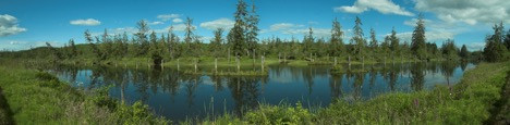
The Hoquiam River is bordered by the Wishkah to the east and the Humptulips and Chenois (Snoose) and Grass Creeks to the west. All these rivers and creeks are typical of the low grade rivers of Washington from the Columbia up into the lower reaches of the Olympic Peninsula. Here the Cascade Mountains move inland and the rivers are a maze of tidal sloughs and forks. The Hoquiam is made from the Little Hoquiam, and West, Middle, and East forks of the Hoquiam proper. With an average annual precipitation of 69 inches and an average temperature of 49 degrees Fahrenheit it is a rainforest drainage, located in an area that is capable of creating immense biomass, however, almost the entire drainage is occupied with Douglas Fir plantations. The name “Hoquiam” is supposedly a local indigenous word meaning “hungry for wood” owing to the large log jams that would form at the mouth of the river. Early settlers recognized the value of the river and its timber and built several mills along it length. Today the only two operating mills left have turned their backs to the river, as have most of the ship yards and canneries that once lined its banks. The Little Hoquiam Shipyard still produces commercial and charter fishing boats and motor yachts. The City of Hoquiam owns 7,500 acres of the watershed, including reservoirs on Davis Creek and the West Fork Hoquiam River. This reserve system serves as the source of Hoquiam's municipal water needs. Today the Quinault Indian Tribe (QIN) and non-tribal commercial fishermen run drift nets for salmon in Grays Harbor near the mouth of the Hoquiam River but do not gill-net the river itself. Recreational fishermen can fish for and retain chum, coho, and chinook salmon, coastal cutthroat, and steelhead (with mandatory retention of hatchery steelhead) from June-February.
Location: Grays Harbor
Major Contributing Streams: East, West, and Middle Fork Hoquaim Rivers, Little Hoquiam River, and the North Fork Little Hoquiam River
River Length: Main stem Hoquiam (6 miles) All tributaries combined (58 miles)
Drainage area: 98 sq miles
Main Tributary Length: East Fork Hoquiam River (22 miles), West Fork Hoquiam River (9 miles), Middle Fork Hoquiam River (9 miles)
Secondary Tributary Length: Little Hoquiam River (6 miles) North Fork Little Hoquiam River (6 miles)
Threats:
Threats from hatcheries: Stocking was discontinued in 2006 when the last 18,000 steelhead smolt were released into the East Fork of the Hoquiam River.
Threats from habitat degradation. Westway Terminal Company’s (Cotanda) proposed crude oil storage and shipping facility at the Port of Hoquiam. Additionally, the basin has been historically (and up to the present) heavily logged
Threats from over harvest. Quinault Indian Nation and non-tribal commercial drift-net fishing near mouth of river in Grays Harbor. Incidental by-catch of non-target species, especially fall Chinook and Chum. Fish are removed from gillnets and released, but with questionable survival rates.
News and media within the basin:
Videos
News articles http://kbkw.com/court-throws-wrench-in-plans-for-grays-harbor-oil-terminal/
Accomplishments:
What have watershed advocates accomplished in the area?
Conservation Partners within the Basin:
Twin Harbors Fish and Wildlife Advocacy http://fishingthechehalis.net/
Chehalis Basin Fisheries Task Force Project http://www.cbftf.com/index.html
Chehalis River Basin Land Trust http://www.chehalislandtrust.org/
Friends of Grays Harbor http://www.fogh.org/