Brief Description of the watershed:
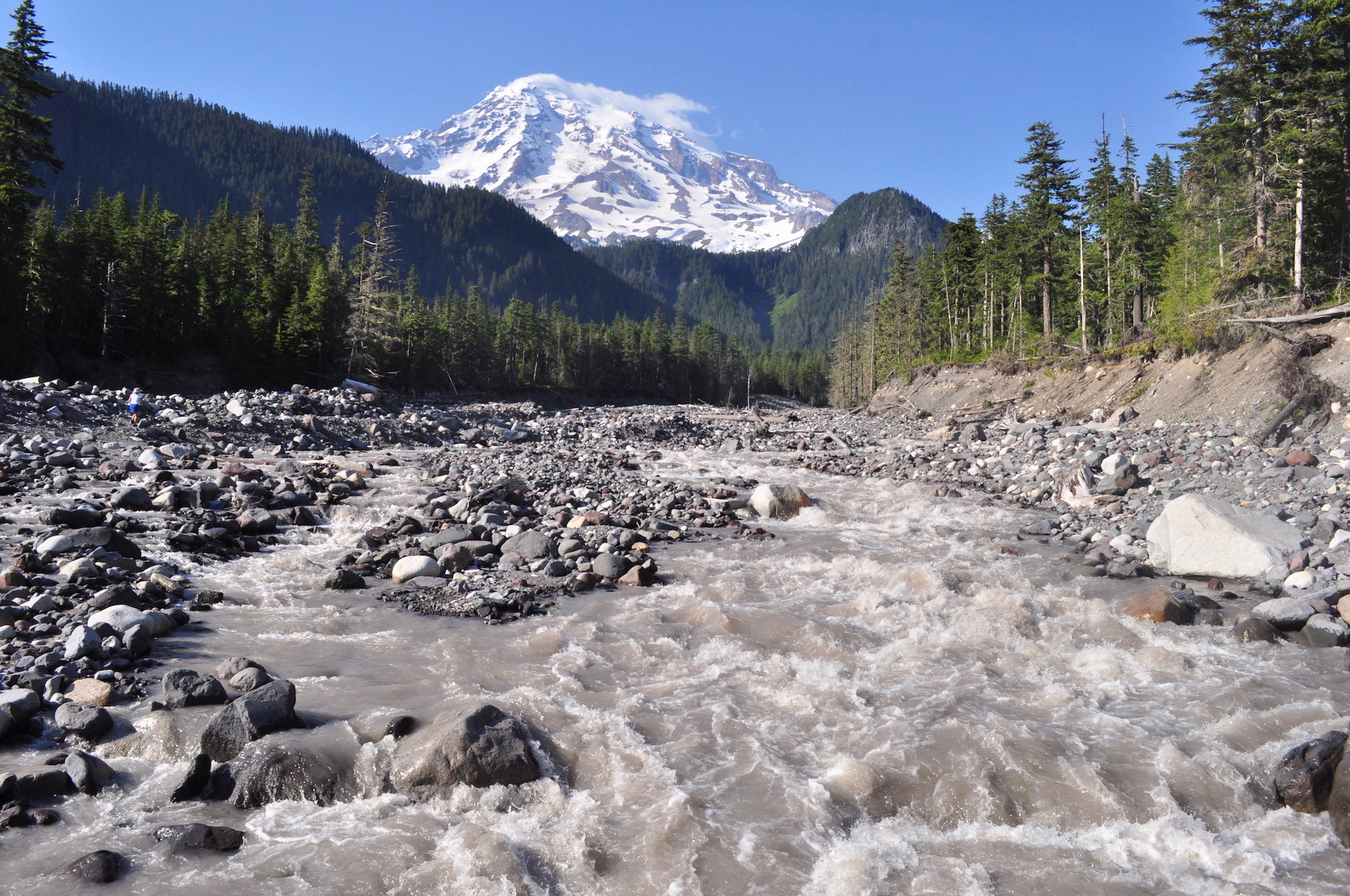
The Nisqually river begins in the Western Central Cascades of Washington as melting snow on the southern slope of Mt. Rainier, and flows 78 miles downstream into Puget sound.
Alder and LaGrande Dams are both constructed above existing natural barriers and do not block anadromous fish populations. In 2003, the Nisqually River Project was certified as Low Impact by the Low Impact Hydro power institute’s voluntary certification program. The project provides Power to approximately 43,000 homes.
Bordered by National forest land, Joint Base Lewis McChord, the Nisqually Indian Reservation, and the Nisqually National Wildlife Refuge, the river enters Southern Puget Sound. The Nisqually is one of the healthiest and least developed rivers in southern Puget Sound.
Land use and ownership patterns in the upper watershed is 78% forestry and recreation, 18% national park lands, 2% agriculture and 2% urban. In the lower watershed 22% forestry, 18% forest/prairie (military-owned), 4% agriculture, 49% rural/residential, 3% residential, 2% urban.
Located in Thurston, Pierce and Lewis counties, cities in the watershed include Eatonville, Roy and Yelm
In a Trust for Public Land study released in 2001, the Nisqually river basin was listed among the ten most important rivers in Puget Sound for salmon recovery. This is in part due to the fact that the lower portion of the river is considered among the best remaining intact salmon habitat. Between river miles (RM) 4.5 and 12.7, the river meanders freely across the valley floor; large woody debris is present in large amounts, and there is a healthy riparian zone. The Nisqually River also has the largest undeveloped delta in Puget Sound.
The 76%, or 64 of the approximately 84 miles, of the Nisqually's riparian area in the anadromous portion of the river are in permanent conservation protection.
After a century of diking off tidal flow, the Brown Farm Dike was removed the restoration of tidal hydrology to 1,878 acres of the Nisqually River estuary. the Nisqually Delta represents the largest tidal marsh restoration project in the Pacific Northwest to assist in recovery of Puget Sound salmon and wildlife populations.
In November 2009, 5 miles of dike surrounding portions of the Nisqually River estuary were removed, restoring 760 acres of historical tidelands to tidal influence. Together, the Nisqually National Wildlife Refuge and its partners (Nisqually Indian Tribe and Ducks Unlimited) have restored over 35 kilometers of historical tidal slough systems. These efforts are expected to substantially increase the ecological health of the Nisqually River estuary and the south Puget Sound.
Thirty to forty years ago, steelhead spawning runs averaged in the range of 6,000 fish, but the population crashed by 90 percent in the 1990s and continued on a downward spiral through the first decade of this century. No hatchery-origin winter steelhead have been released into the watershed since 1982, and the number of wild steelhead spawning in the river increased to more than 1,000 fish in 2015 and more than 2,000 in 2016 from a low of 269 in the 2012.
In August 2016 the Nisqually was designated by the WDFW as a wild steelhead gene bank. Gene banks are rivers managed exclusively to protect, restore and sustain wild steelhead. Hatchery steelhead are excluded from rivers with this designation, to protect wild fish from the harmful effects of hatchery-raised fish such as interbreeding and competition for food and habitat.
Tacoma Power fully funds the operation of the Nisqually Tribe's Clear Creek Hatchery. This hatchery produces approximately four million Chinook smolts and one million coho smolts each year. These planted hatchery fish result in adult returns to the hatchery of approximately 12,000 adult Chinook and up to 4,000 adult coho annually. The harvest management portion of the recovery plan is based on the hypothesis that achieving the natural escapement goal of 1,100 combined natural and hatchery origin fish will provide sufficient natural spawning to create a sustainable, locally-adapted Chinook run in the Nisqually River.
Basin Stats:
- Location: 8 miles North of Olympia, Wa.
- Major Contributing Streams:
- River Length: 78 Mi
- Drainage area: 720 Mi
- Tributaries:
- Van Trump Creek
- Paradise River
- Muck Creek*
- Yelm Creek*
- Tanwax Creek*
- Ohop Creek *
- Mashel River *
- Little Nisqually River
- East Creek
- Mineral Creek
- Big Creek
- Kautz Creek
- River Length: 78 Mi
* Known Steelhead spawning tribs.
All are used as spawning tribs by other anadromous species.
Threats:
- Threats from Hatcheries: Chinook, Coho stocking
- Threats from habitat degradation: Dissolved O2, sediment, high temp.
- Describe threats from over harvest? Nisqually tribe conducts a non-selective gill net fishery. Bycatch by recreational anglers can be an issue on this river.