Location
Southwest Washington: The Lewis River headwaters begin on the summit of Mt. Adams (12,270 feet). Beginning in Skamania County the river flows generally west/southwest, forming the border of Clark and Cowlitz Counties before entering the Columbia River a few miles SW of Woodland, Washington.
Climate
The climate is typified by mild, wet winters and warm, dry summers. Average annual precipitation ranges from 73 inches at Merwin Dam to over 115 inches in the upper basin. Much of the precipitation falls as snow in the higher elevations, contributing to streamflow from meltwater in dry summer months.
Geology
The Lewis basin has developed from volcanic, glacial, and erosional processes. Mount St. Helens and Mt. Adams have been a source of volcanic material as far back as 400,000 years ago. More recent volcanic activity, including pyroclastic flows and lahars, has given rise to the current landscape. Glaciation has shaped the valleys in upper portions of the basin as recently as 13,000 years ago. Oversteepened slopes as a result of glaciation, combined with the abundance of ash, pumice, and weathered pyroclastic material, have created a relatively high potential for surface erosion throughout the basin.
Land Use:
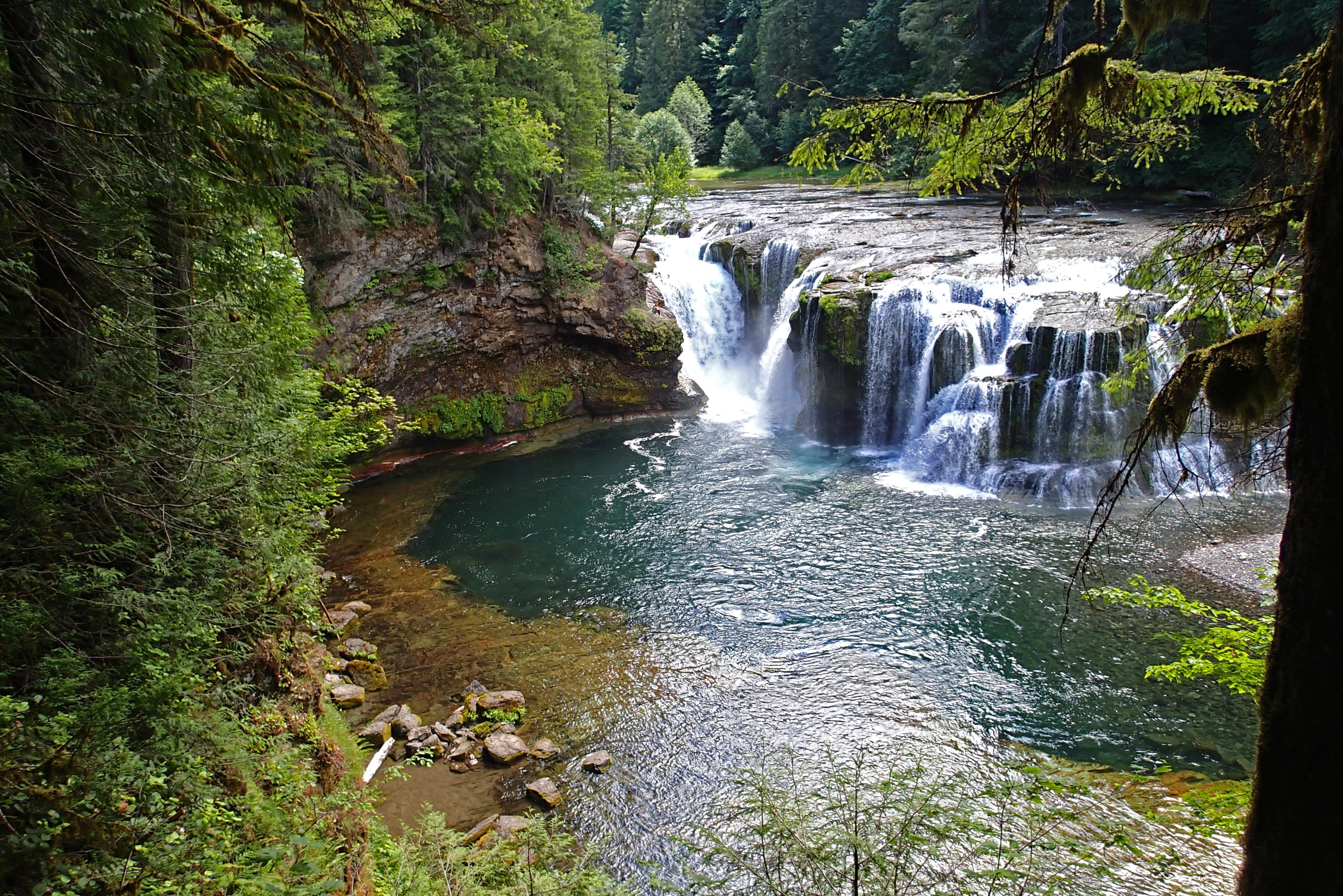
The bulk of the land is forested and a large percentage is managed as commercial forest.The lower 12 miles of the mainstem flow through a broad, alluvial valley characterized by agriculture and residential uses. Development on the lower river has increased dramatically in recent years.
Basin Stats
River Length: 95 miles
Drainage area: 1,406 Square miles
Major Contributing Streams: Rush Creek, Pine Creek, Cedar Creek (provides some of the most productive anadromous fish habitat in the North Fork basin), Colvin Creek, Siouxon Creek, Cougar Creek, Swift Creek, Muddy river, Canyon Creek, Speelyai Creek, Ross, Creek, Johnson Creek
Native Fish:
Bull Trout (ESA: Threatened 1999 )
Winter Steelhead (ESA: Threatened 1998)
Summer Steelhead (ESA: Threatened 1998)
Coho Salmon (ESA: Candidate 1995 )
Spring Chinook(ESA: Threatened 1999)
Fall Chinook (ESA: Threatened 1999)
Chum Salmon (ESA: Threatened 1999)
Kokanee
Rainbow Trout
Cutthroat Trout (anadromous, fluvial and adfluvial exist in the Basin)
Mountain Whitefish
Pacific Lamprey
Threats
Hatcheries
The Lewis River Salmon Hatchery at RM 13, approximately 4 miles downstream of Merwin Dam, was completed in 1932. It has produced fall Chinook, spring Chinook, and coho.
The Speelyai Hatchery on Speelyai Bay in Merwin Reservoir was completed in 1958. It produces spring Chinook and coho smolts in coordination with the Lewis River Salmon Hatchery.
The Lewis River net pen system in Merwin Reservoir has been in operation since 1979, serving as a rearing location for hatchery steelhead.
The Merwin (Ariel) Hatchery below Merwin Dam (at RM 16) was completed in 1983 and produces summer and winter steelhead.
Habitat Degradation
Passage: Merwin Dam presents a passage barrier to all anadromous fish, blocking up to 80% of the historically available habitat. Culvert related passage problems are located on Johnson, Cedar, Beaver, John, Brush, and Unnamed Creeks. Other passage problems exist on Robinson, Ross, and Pup Creeks.
Water Quality and Temperature: Water temperatures at Amboy and at the mouth of Cedar Creek often exceed 61F in the summer and sometimes reach 73-77F potentially impacting steelhead juveniles. High temperatures have been attributed to agriculture, grazing, water withdrawals, surface runoff, residential development, forestry operations, and the construction of illegal dams and diversions throughout the basin.
Side channels: Side channel habitat has been removed from the lower seven miles of the mainstem due to diking.
Woody Debris: Large woody debris quantities and recruitment potential in the mainstem and tributaries are considered poor. This has been attributed to logging, stream cleanouts, and poor riparian conditions.
Invasive Species: Invasive reed canary grass has become a problem along the Muddy River. Native riparian plants are intrinsically tied to the health of fish and aquatic invertebrates they protect. One of the main ways to wipe out reed canary grass is to crop it low and plant trees that will shade it out. This has the added benefit of decreasing stream temperatures.
Riparian and Floodplain function: Reduced due to development and past resource exploitation.
Climate Change:
Higher water temperatures: Impacts to fish phenology, survival, productivity, and habitat, particularly salmon, steelhead, and bull trout. Thermal barriers preventing migration and genetic interchange for aquatic species. Altered structure and abundance of aquatic invertebrates, plants, microbes, and nutrients.
Altered streamflow patterns and timing: Impacts to life stages of salmonids, including eggs, juveniles, and adults. Decoupling of seasonal interactions.
Increased frequency of high flow events: Scouring of spawning substrate and eggs, affecting winter and spring spawning salmonids; reduced overwinter fish survival, especially juveniles; road failures increase sediment delivery.
Low summer flows: Habitat and population fragmentation; reduction in available habitat; drought impacts in surrounding floodplains; exacerbated in-stream and riparian microclimate warming.
Opportunities to Improve Habitat for Native Fish
Floodplain and side-channel reconnection
Road reduction
Dam removal and stream crossing structure upgrades
Expansion of Wild and Scenic River designations
Management and expansion of riparian buffers to restore natural function
Reintroduction of beavers
Reduction in grazing and restoration of areas currently impacted by grazing
Planting of riparian trees in denuded areas
Control of invasive plants
Addition of large wood
Restoration of incised channels
Increase in surveys and monitoring with improved data sharing
Hydropower
Four Hydro power Projects exist on the Lewis River.
Built in 1931, the Merwin dam is 313-foot high and presents a passage barrier to all anadromous fish, blocking up to 80% of the historically available habitat.
The Yale project was completed in 1953. It features a 3,780-acre reservoir (locally known as Yale Lake) and a main earthfill embankment dam that is 323 feet high.
At 240 mw, Swift No. 1 is PacifiCorp’s largest hydroelectric facility. When initially built in 1958, the 512-foot Swift Dam was one of the highest earthfill dams in the world. The Swift Reservoir is 4,600 acres.
The discharge of Swift No. 1 enters a canal that transports the water through the 70 mw Swift No. 2 project before it is returned to the upper end of Yale Reservoir.
Merwin, Yale, Swift No. 2, and Swift No.1. Merwin , Yale , and Swift No. 1 are owned and operated by PacifiCorp. Swift No. 2 is owned by Cowlitz County PUD No. 1 and is operated in coordination with the other projects by PacifiCorp.
Fish Passage: Construction work began in April 2011 on new non-volitional fish passage facilities on the Lewis river. The new facilities will collect adult fish at Merwin Dam and transport them upstream of Swift Dam where they will be released and can move up the river to spawn. As their young begin migrating to the ocean, they will be collected at Swift Dam by a floating surface collector and transported by truck downstream to a release facility in the lower river. If successful, these projects will open up 117 miles of salmon and steelhead habitat upstream of Swift.
The Colvin Dam, located on Colvin Creek and affecting fish habitat along the North Fork of the Lewis River, has been proposed for removal by the Cowlitz Tribe.
Over Harvest
Fish from the Lewis River Basin are harvested in ocean commercial and recreational fisheries from Oregon to Alaska, in addition to Columbia River commercial gillnet and sport fisheries.
There is some poaching and mortality related to being hooked by anglers targeting hatchery origin fish on the river.
Conservation Partners within the Basin
Lower Columbia Fish Enhancement Group
Lower Columbia Fish Recovery Board
Clark-Skamania Fly-Fishers
Salmon Creek Fly Fishers
Clark County Chapter of Trout Unlimited
Cascade Forest Conservancy
US Forest Service
US Fish & Wildlife Service
Friends of the East Fork
Fish First
For more information regarding the North Fork Lewis River watershed, visit these links:
Links to watershed prioritization plans, recovery plans, historical accounts: http://www.lewisriver.com/
Sources
https://www.nwcouncil.org/media/21075/Vol._II_Ch._...
https://www.nwcouncil.org/media/21072/Vol._II_Ch._...
https://cascadeforest.org/wp-content/uploads/Wildl... 017.pdf